Four new councils and a lot of unanswered questions
Four authorities, fourteen councils to unwind, and less than two years to build a new system of local government

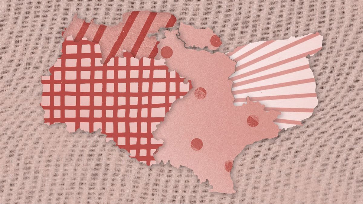
The government has chosen Option 4B for Kent’s local government reorganisation, replacing Kent County Council, Medway Council and the county’s 12 district authorities with four new unitary councils in April 2028. We examine why Whitehall backed an unexpected compromise, what the new map means across Kent, and the huge practical challenge of turning fourteen councils into four.
Four new councils and a lot of unanswered questions
The first sign that Kent’s political map had changed wasn’t an announcement.
It was the rumours.
Kent County Council was in the first hour of its meeting yesterday morning when word began to circulate that Whitehall’s decision on local government reorganisation had arrived.
Then came the verdict from a passing councillor.
“4 fucking B?!”
It wasn’t outrage. It wasn’t celebration either. It was disbelief.

For months, councillors, council leaders and local government officers had convinced themselves they knew roughly where this was heading. Some thought ministers would favour the stronger financial case for three authorities. Others believed Medway had gained ground with its argument for four councils built around modern communities rather than existing district boundaries. Almost nobody seemed to think the government would simply reach into the pile of competing business cases and emerge with Option 4B.
But that is exactly what happened. Just after lunchtime, ministers confirmed that Kent County Council, Medway Council and the county’s 12 district councils will all disappear on 1 April 2028. In their place will come four entirely new unitary authorities responsible for virtually every major local service, from social care, education and highways to housing, planning, libraries and bin collections.
Kent County Council has existed since 1889. The two-tier structure, in which county and district councils share responsibility, has shaped local government for decades. Within less than two years, everything will change. Elections to shadow authorities are expected next spring, with those councils spending a year preparing to take over before formally assuming responsibility in April 2028.
The destination itself has not been a surprise for some time. Ever since the government told Kent that local government reorganisation would need to come before any future devolution deal, the question has never really been whether the existing system would disappear. It has been what would replace it.
That seemingly simple question produced eighteen months of increasingly complicated politics.
Five business cases eventually reached ministers’ desks. Kent County Council argued for a single authority covering almost 1.9 million people. A coalition of councils made the case for three authorities, claiming they offered the strongest financial future. Medway wanted four councils too, but believed ministers should take the opportunity to redraw boundaries that no longer reflected how people actually lived and travelled.
Instead, Housing Secretary Steve Reed chose the proposal submitted by Dover, Swale and Thanet councils. Known simply as Option 4B, it largely preserves the existing district map while grouping Kent into four new authorities: North Kent, West Kent, Mid Kent and East Kent.
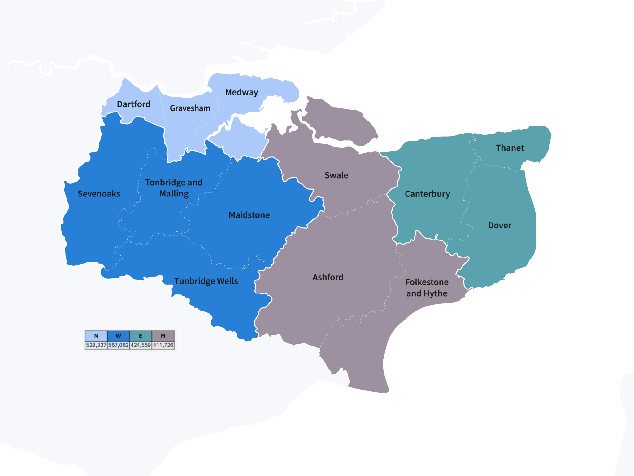
On paper, it looks like a compromise. In practice, it represents something rather more significant. Whitehall has settled the biggest political argument Kent’s councils have had in decades, but in doing so, it has ignored much of the local debate.
The councils spent eighteen months arguing with one another over the future shape of Kent. The government listened, then made its own choice.
Kent County Council, under Reform control, made the boldest case of all. Rather than dividing the county into several authorities, it proposed abolishing every existing principal council and replacing them with a single unitary authority covering the whole of Kent and Medway. It argued this would be the cheapest model to establish, deliver the greatest long-term savings and avoid the complexity of splitting county-wide services between multiple successor organisations.
Even before Thursday’s announcement, ministers had repeatedly described authorities of around 500,000 people as their guiding principle. A council serving almost 1.9 million residents always looked like a difficult sell. Steve Reed’s decision letter confirmed as much. The proposal, he wrote, raised “significant concerns” because its scale far exceeded the government’s expectations. He also questioned how services could realistically be delivered across such a large area and how its untested federated model would work.
It was the only Kent proposal that ministers concluded failed to meet their criteria.
If the one-authority model had always felt unlikely, the real contest had increasingly centred elsewhere.
For much of the process, the three-authority solution appeared to offer the most credible alternative. Supported by several councils and scoring highly in Kent County Council’s own options appraisal, it promised lower implementation costs, greater recurring savings and authorities comfortably within the population range ministers had originally indicated they preferred.
Medway was never persuaded.
Council leader Vince Maple spent much of the past year arguing that the debate had become too focused on financial modelling and not enough on democracy. Four authorities, he maintained, would keep decision-making closer to residents and offer a once-in-a-generation opportunity to redraw boundaries that no longer reflected how people lived, worked and travelled. His preferred 4D proposal would have done exactly that, breaking with some existing district boundaries in pursuit of what supporters argued was a more coherent long-term geography.
Ministers accepted half of that argument. Kent will have four councils, not three, but the more ambitious boundary changes disappeared.
Instead, the government opted for 4B, the proposal put forward by Dover, Swale and Thanet councils. It achieves four authorities while preserving the existing district map, creating North, West, Mid and East Kent without the additional complexity of redrawing local boundaries before the transition had even begun. It is, in many ways, a compromise.
But if this was not the cheapest proposal or the one commanding the widest local backing, what was it about 4B that persuaded Whitehall?
Register for free to continue reading our analysis of why ministers chose this map, where it makes sense, and what Kent’s four new councils could look like in practice.